Buying on the water in Port St. Joe is a dream, but the fine print around riparian rights can make or break how you actually use your shoreline. You want to know if you can build a dock, moor a boat, or trim vegetation without running into trouble. This guide explains what riparian rights mean in Florida, how they work on St. Joseph Bay, and what to check before you buy. You will walk away with a plain‑English checklist, local tips, and a clear plan for due diligence. Let’s dive in.
What riparian rights mean
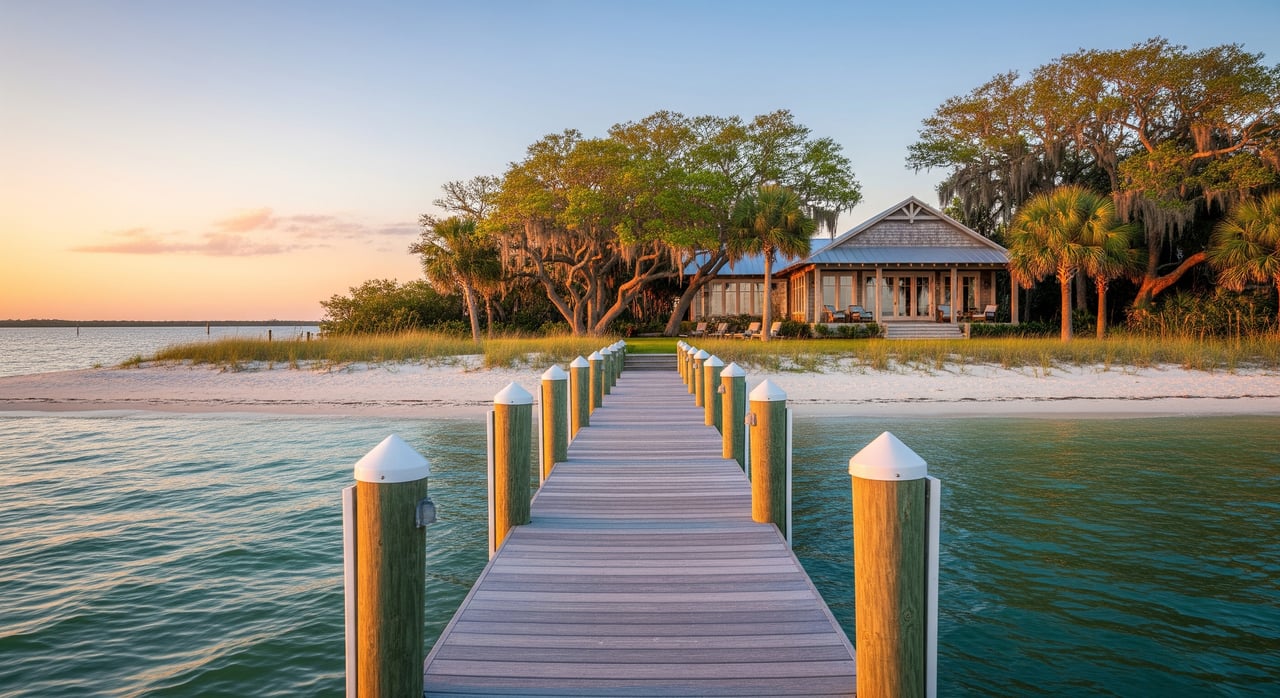
Riparian and littoral rights are the uses that come with owning land that touches the water. If your property fronts a bay, gulf, or ocean, you are a littoral owner. If it fronts a river or navigable inland water, you are a riparian owner. In both cases, you typically have reasonable access to and use of the adjacent water, including navigation and enjoyment of views.
These rights are not unlimited. The state holds the seabed and tidal lands seaward of the mean high‑water line in trust for the public. That area is often called sovereign submerged lands. Your private upland generally stops at the mean high‑water line, and activities beyond it are regulated.
Coastlines also change over time. Slow, natural additions of sand or sediment, called accretion, can shift the boundary in your favor. Sudden changes, called avulsion, usually do not change the legal boundary. If a shoreline shift is recent or disputed, consult qualified professionals.
Key limits in Port St. Joe
St. Joseph Bay and nearby waters include sensitive habitats like seagrass beds and fisheries. That means some waterfront projects face closer review. The Florida Department of Environmental Protection and the state trustees manage sovereign submerged lands, and many activities require permits. You also need to follow local Gulf County building and zoning rules.
The public generally has the right to navigate, fish, and recreate on sovereign submerged lands. Your rights to use the water must coexist with those public uses and with environmental protections.
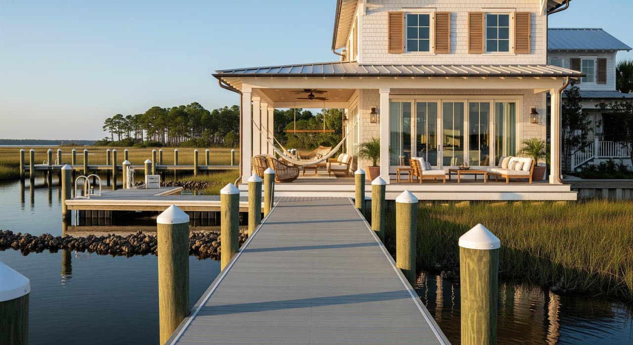
Docks and mooring
You do not automatically get to build a dock, even if your lot touches the bay. Dock construction and boat mooring usually require permits from state and federal agencies, and often a county permit. If a dock extends over sovereign submerged lands, the state may also require a lease or written authorization.
In mapped seagrass or manatee areas, docks may need special design, limits on size, or mitigation. Navigation channels and safety zones can also restrict where a dock can go.
Shoreline structures
Seawalls, revetments, and similar hardening are regulated to protect habitat and water quality. In sensitive stretches of St. Joseph Bay, agencies may favor living shorelines over new seawalls. Existing structures should have permits and may carry maintenance or repair conditions.
Vegetation and mangroves
Shoreline vegetation, including mangroves, is protected. Trimming or removal is regulated and may only be allowed under specific rules or permits. Limited pruning can be authorized, but do not cut before you confirm what applies to your property.
Views and access
Your right to a view is not absolute. Zoning, height limits, and recorded restrictions control what neighbors can build. Public access easements, conservation easements, or recorded beach access across a property can shape how you reach the water. Always verify any easements on the plat, deed, and title documents.
Flooding and insurance
Most waterfront lots fall within FEMA flood zones. Lenders may require flood insurance, and premiums depend on elevation, structure type, and mitigation features. Docks and shoreline structures can be costly to repair after storms, so factor maintenance and replacement costs into your budget.
Where to verify rights
- Deed and plat: Check the Gulf County Clerk of Court records for your deed and recorded subdivision plat. Plats often show lot lines, shoreline, and any access easements.
- CC&Rs and HOA rules: Neighborhood rules can set dock sizes, prohibit certain shoreline improvements, or limit vegetation work.
- Title and survey: A recent, certified boundary survey should show the mean high‑water line and any encroachments. Title commitments disclose recorded easements and restrictions that run with the land.
- Permit history: Look for county building permits, state permits, and federal authorizations tied to the property for docks, seawalls, and shoreline work.
- State submerged lands records: Confirm any leases or consents for structures over sovereign submerged lands.
- Environmental overlays: Review habitat maps, navigation charts, and channel locations that could limit dock siting.
- Local rules: Gulf County zoning, shoreline setbacks, and construction standards apply to docks and piers.
Buyer due‑diligence checklist
Gather key documents
- Current deed and recorded plat from the Gulf County Clerk of Court.
- Recorded easements, CC&Rs, and any HOA rules.
- Title commitment or policy, with attention to riparian easements or dock grants.
- Recent, certified boundary survey showing the mean high‑water line and all existing shoreline structures.
- FEMA flood map status and any elevation certificate.
- Permit history from the county, state, and U.S. Army Corps of Engineers.
Ask the seller
- Copies of all permits and as‑built drawings for docks and seawalls.
- Maintenance records and proof of compliance or completion letters.
- Any state lease or authorization for structures over submerged lands.
Hire specialists
- A licensed surveyor with coastal experience.
- A title company or Florida real‑property attorney familiar with coastal issues.
- A coastal permitting specialist or marine contractor to assess dock feasibility and costs.
- An environmental consultant if the lot is near an aquatic preserve or mapped habitat.
Watch for red flags
- Existing dock or seawall with no permit history.
- Recorded public access or conservation easements across the lot.
- Aquatic preserve boundaries or seagrass beds adjacent to the property.
- HOA rules that limit or prohibit docks or shoreline work.
- Signs of unstable shoreline, sudden erosion, or recent deposition disputes.
How rights affect value
Waterfront with clear, permitted dock rights typically commands a premium. The ability to add a lift, moor a boat, or enjoy easy water access is a major lifestyle and resale driver. Buyers in Port St. Joe often pay more for true, usable access compared to a simple water view.
Restrictions reduce value. Properties in no‑dock zones, near sensitive seagrass, or subject to public access easements may see lower pricing and a smaller pool of buyers. In some neighborhoods, HOA rules can further limit shoreline changes, which affects both enjoyment and marketability.
Costs and risk matter. Permitting, construction, annual upkeep, and possible state lease fees add up. After major storms, damage to docks and seawalls can be expensive to address. Lenders may also require proof of permitted structures and clear title, so unresolved issues can complicate financing.
In St. Joseph Bay’s sensitive areas, you may face more scrutiny and design constraints for new docks. That does not make a property less special, but it changes feasibility, timelines, and budgets. Plan for this early and build it into your offer strategy.
Next steps
If you are considering a waterfront property in Port St. Joe, verify the shoreline boundary, confirm any permits and leases, and understand the environmental overlays before you write an offer. With the right due diligence and local guidance, you can protect your investment and enjoy the water with confidence.
If you want a focused, local plan tailored to your goals, reach out to Debbe Wibberg for a personalized market consultation.
FAQs
Dock permits in Port St. Joe: Can I automatically build?
- No; you have a right to reasonable water access, but new docks usually require county, state, and federal permits and may need a state lease over submerged lands.
Ownership question: Who owns the bay bottom in front of my lot?
- The state typically owns sovereign submerged lands seaward of the mean high‑water line; your private title usually runs to that line unless a specific grant says otherwise.
Deed language: Will my riparian rights appear on the deed?
- Sometimes; rights often run with the land even when not listed, but plats, old deeds, or recorded easements may document specific access or dock rights.
Vegetation rules: Can I trim mangroves to improve my view?
- Trimming and removal are regulated; limited pruning can be allowed under state rules, but many activities require permits and coordination before any work.
Shoreline changes: What if the waterline moves over time?
- Slow, natural accretion can shift the boundary, but sudden changes usually do not; boundary questions are fact‑specific and may require professional review.
Existing structures: How do I confirm a dock is legal?
- Ask for all permits and as‑builts, check state and federal permit records, and verify any required state lease or authorization is current, then confirm via survey and title.